


The Atlas volume of Der Neue Brockhaus, published in 1960 by F. A. Brockhaus, Wiesbaden, represents one of the finest examples of mid-20th-century German cartographic and encyclopedic publishing. Issued as part of the Der Neue Brockhaus (third, completely revised edition), this atlas was conceived not merely as a collection of maps, but as an integrated visual companion to a modern general encyclopedia.
This atlas combines geography, economics, and history in a single, carefully structured volume. According to the title page, it contains:
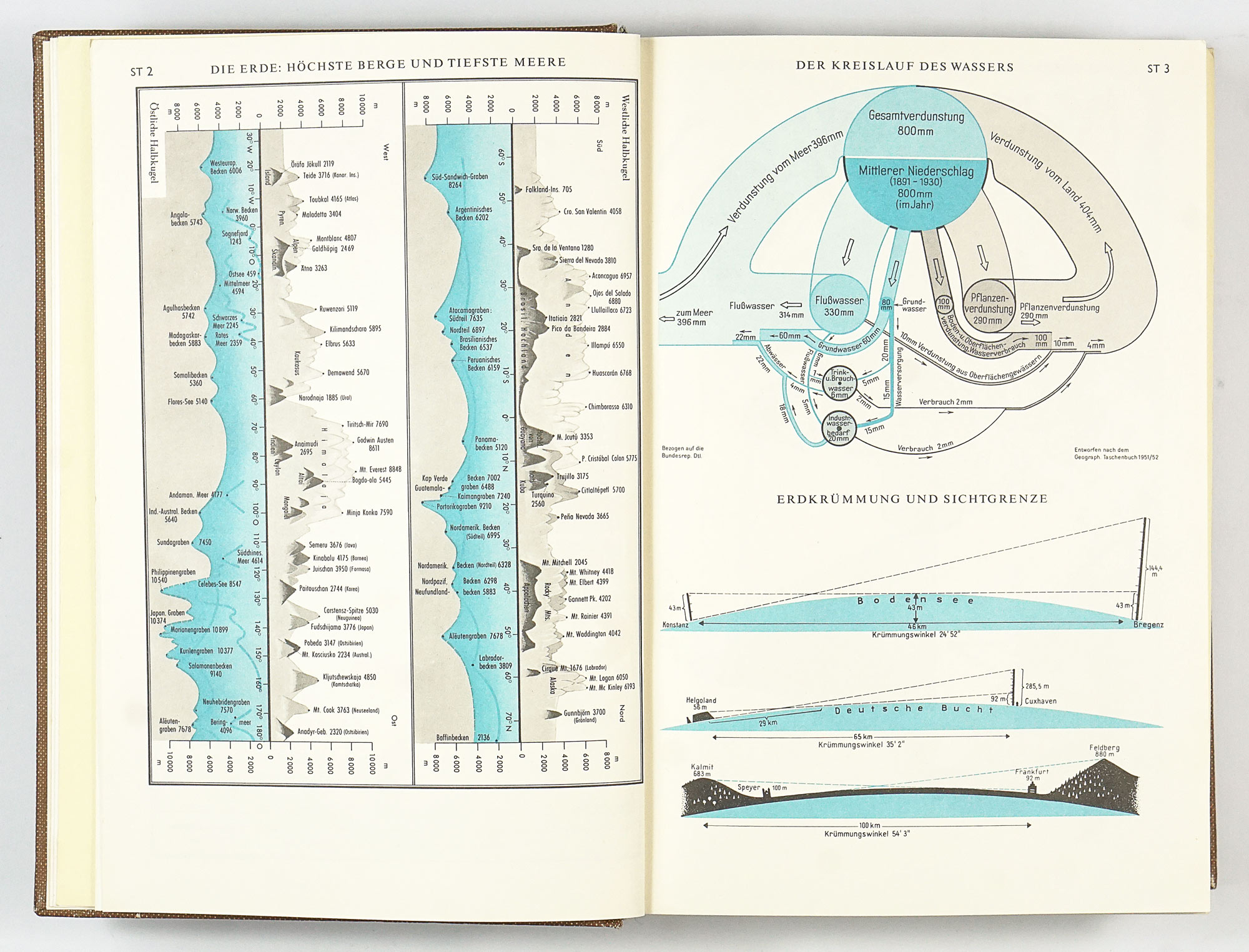
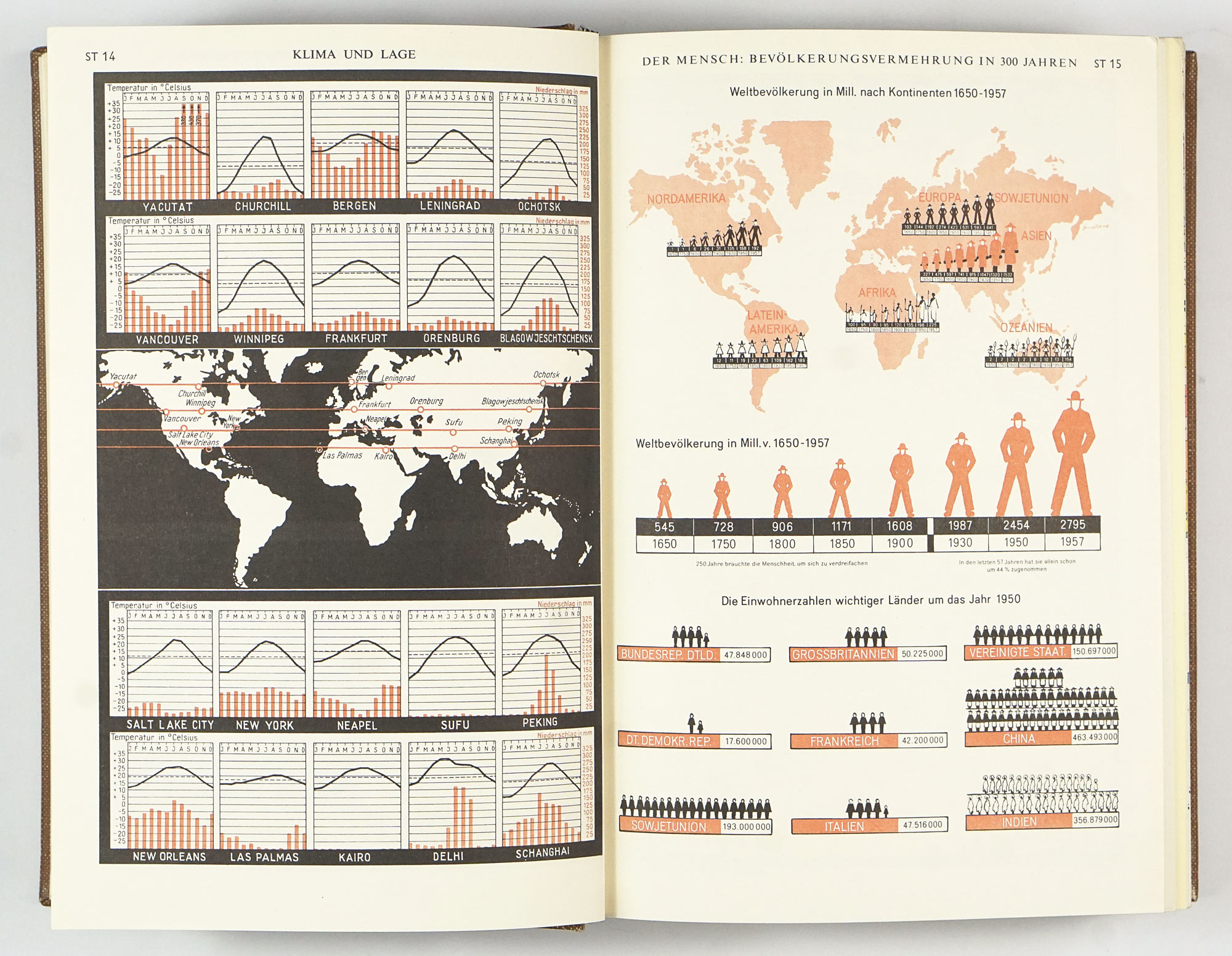
- 375 maps
- 241 photographs
- 70 diagrams and charts
- A comprehensive gazetteer with approximately 75,000 indexed references
The content of the atlas is divided into 4 distinct sections:
1. World and Man
An introductory thematic section addressing the relationship between humanity and the world through statistics and comparative visualizations. Topics include the Earth and the universe, population, culture and education, economy, living conditions, and history. Visually most innovative and creative part of the atlas, with variety of cleverly laid out charts and graphs.
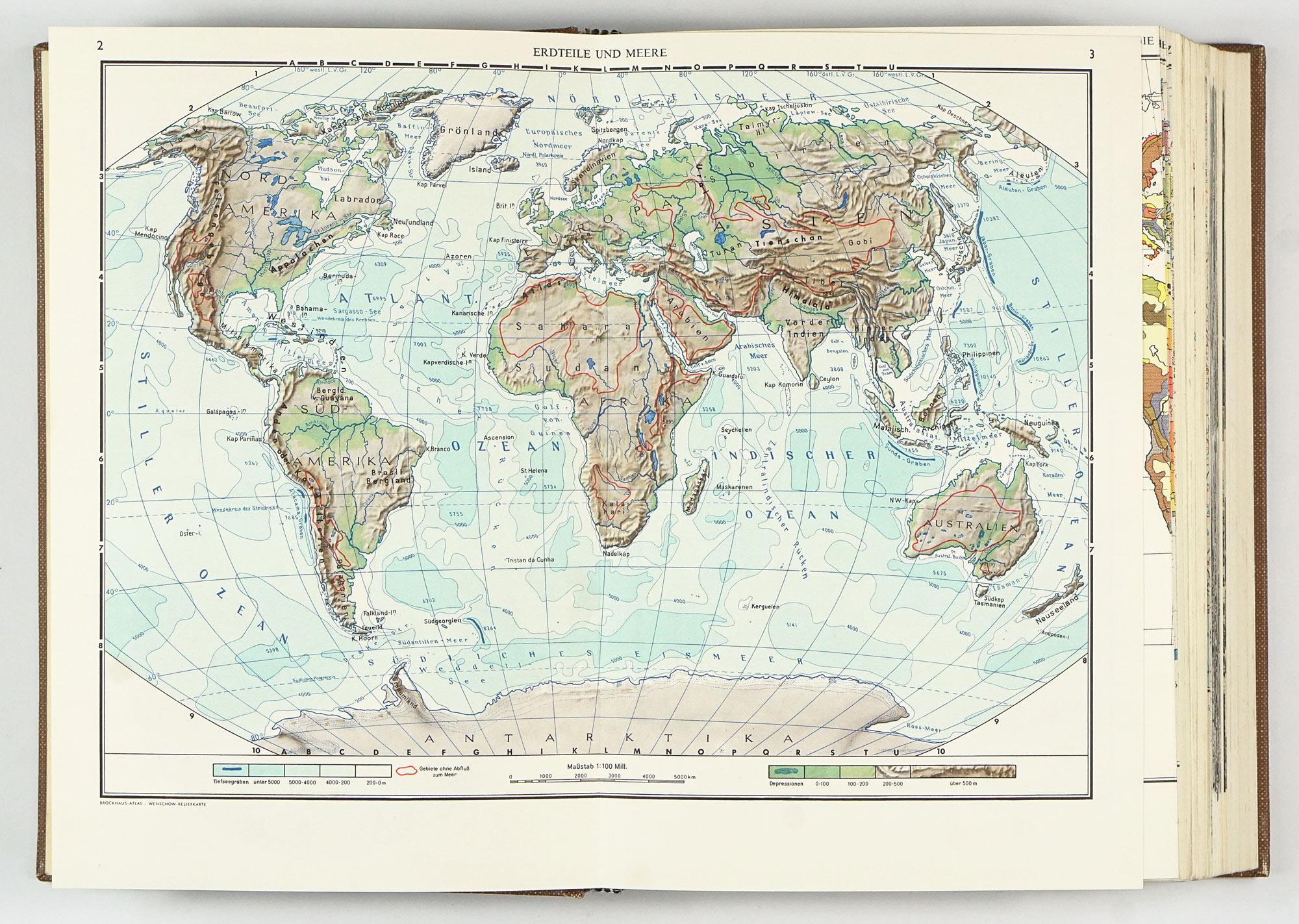
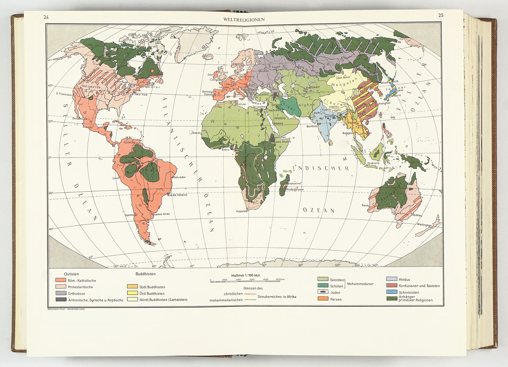
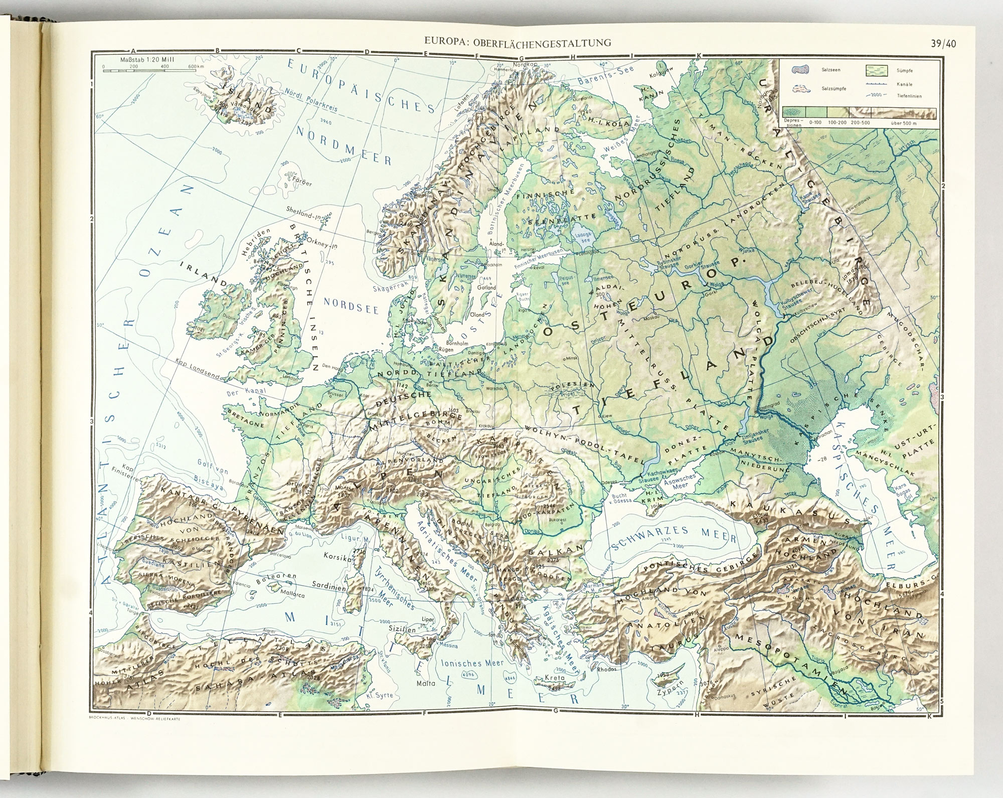
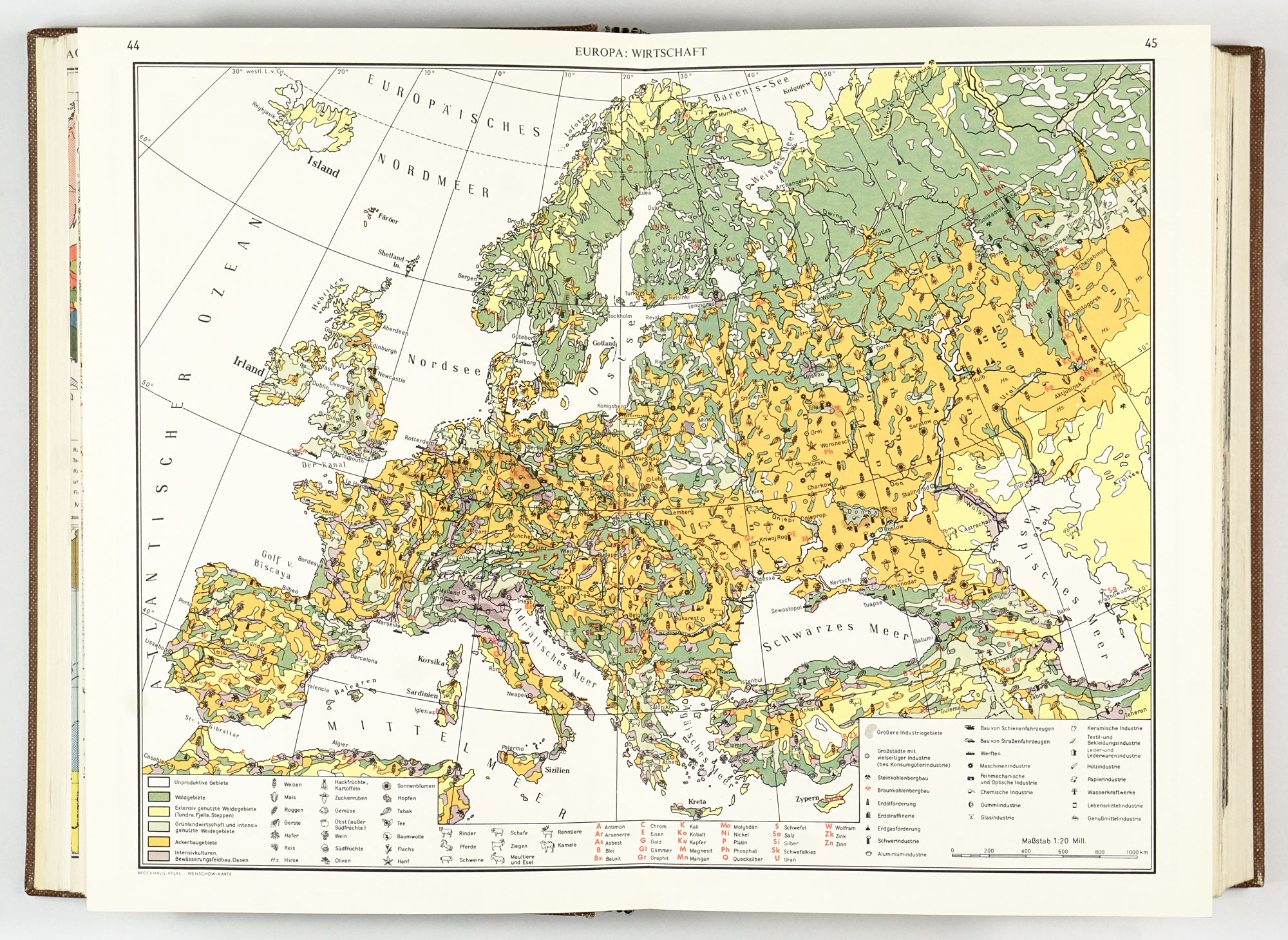
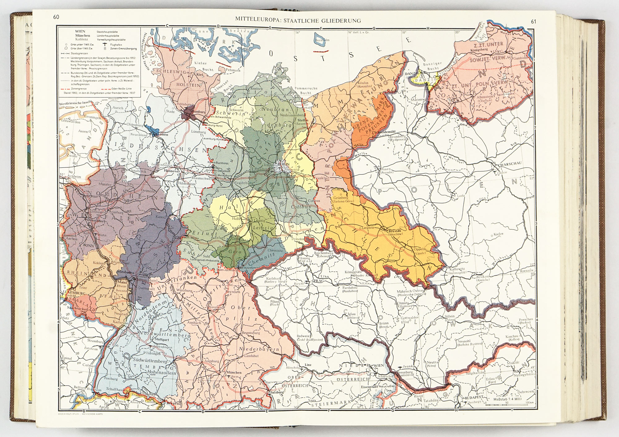
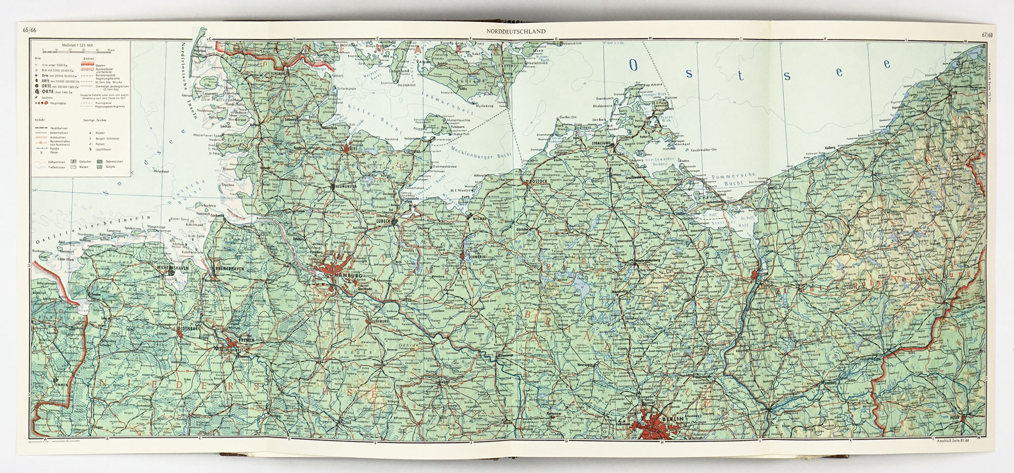
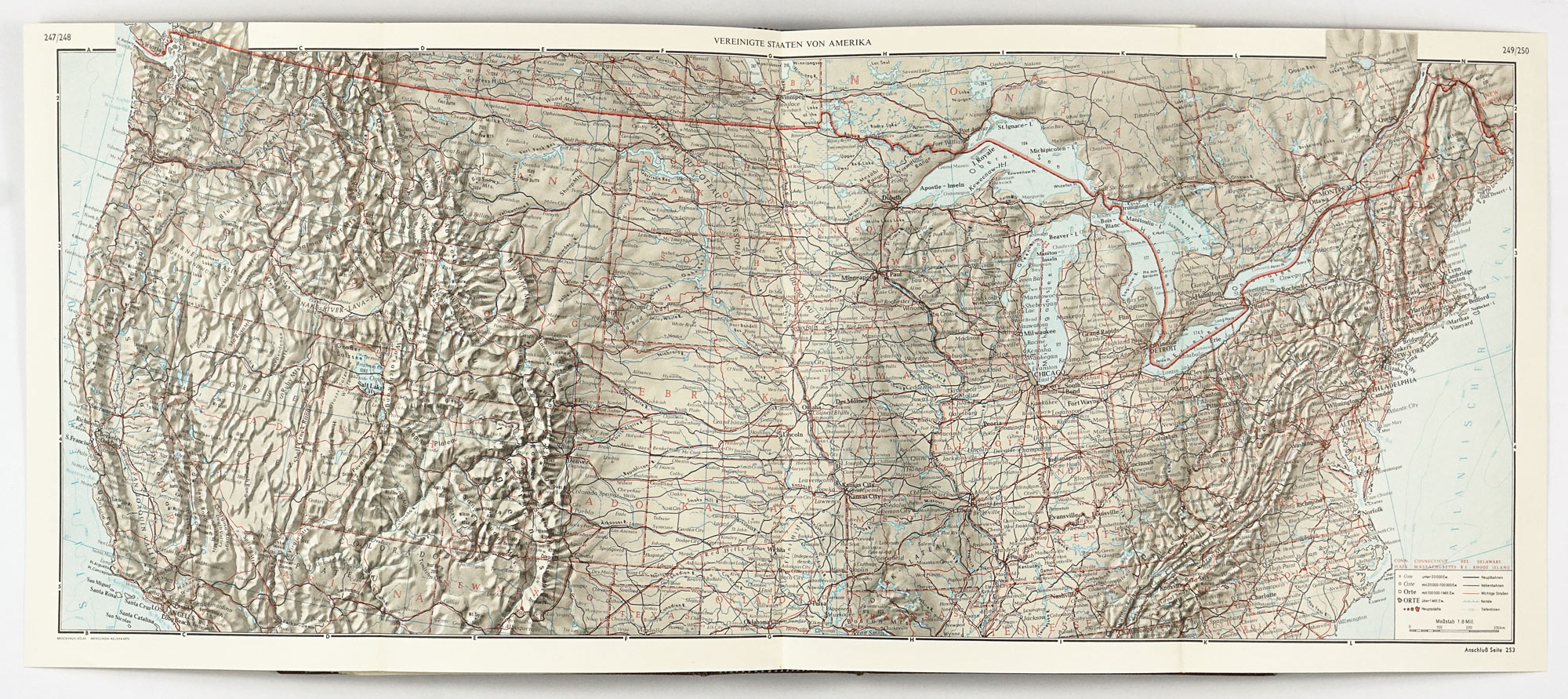
2. Geography maps
The cartographic core of the atlas, providing detailed political, physical and thematic maps forming the backbone of the volume.
3. Images for Geography
A richly illustrated section devoted to landscape forms, natural beauty, and human economic activity, emphasizing visual geography through photographs and explanatory imagery.
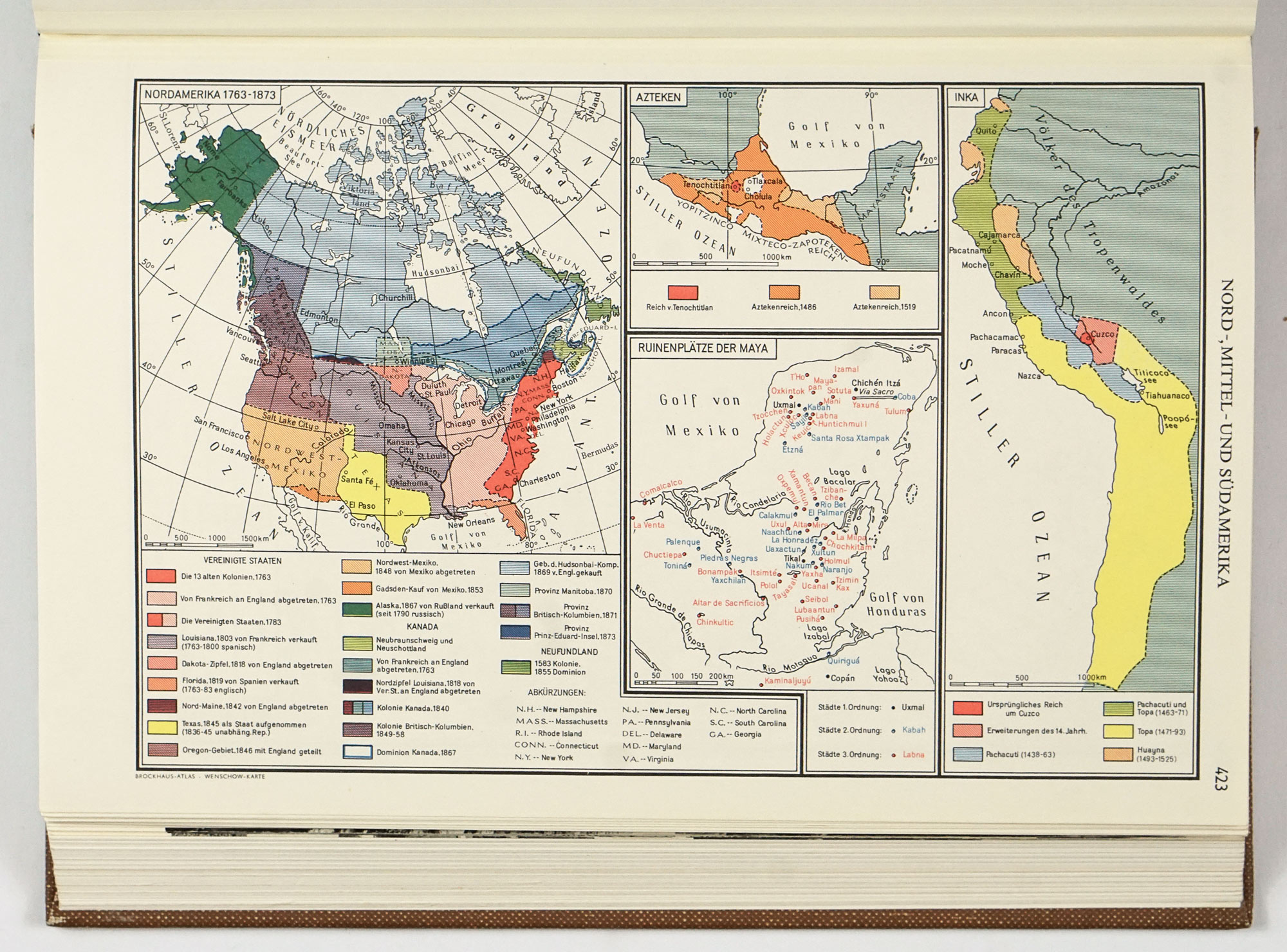
4. World History
Historical maps and illustrations tracing global development from prehistory and antiquity through the Middle Ages to the modern era, integrating spatial and chronological perspectives.
5. Index of names
An extensive index of countries, places, mountains, rivers, lakes, and other geographical features, containing up to 75,000 words.
Published fifteen years after the end of the Second World War, this atlas reflects a period of intellectual renewal and international reorientation in West Germany. It presents the world through a rational, scientific lens, emphasizing economic structures, global interconnections, and historical processes rather than ideological rhetoric. As such, it offers insight not only into geography, but also into how the world was understood and explained at the dawn of the 1960s.
The 1960 Brockhaus Atlas stands as a high-quality reference atlas and an important artifact of 20th-century cartography and a testament to Brockhaus’s enduring publishing standards.


