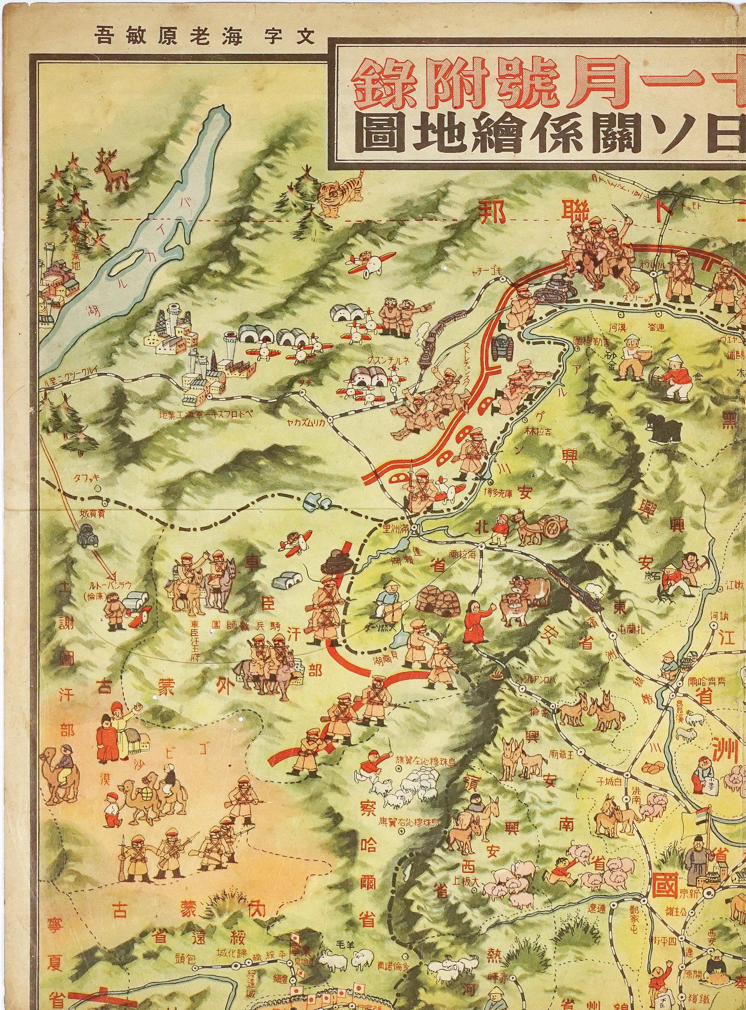
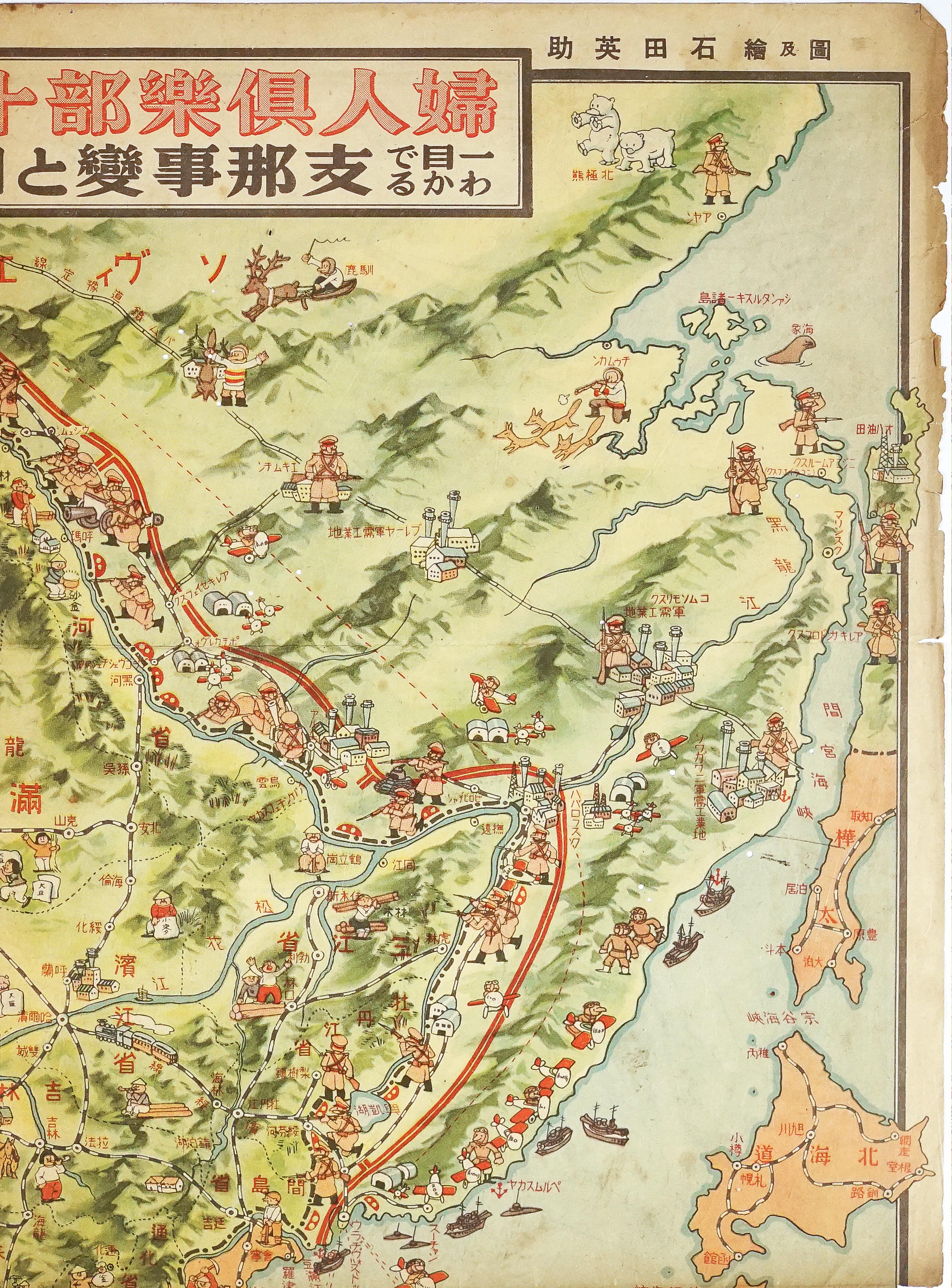
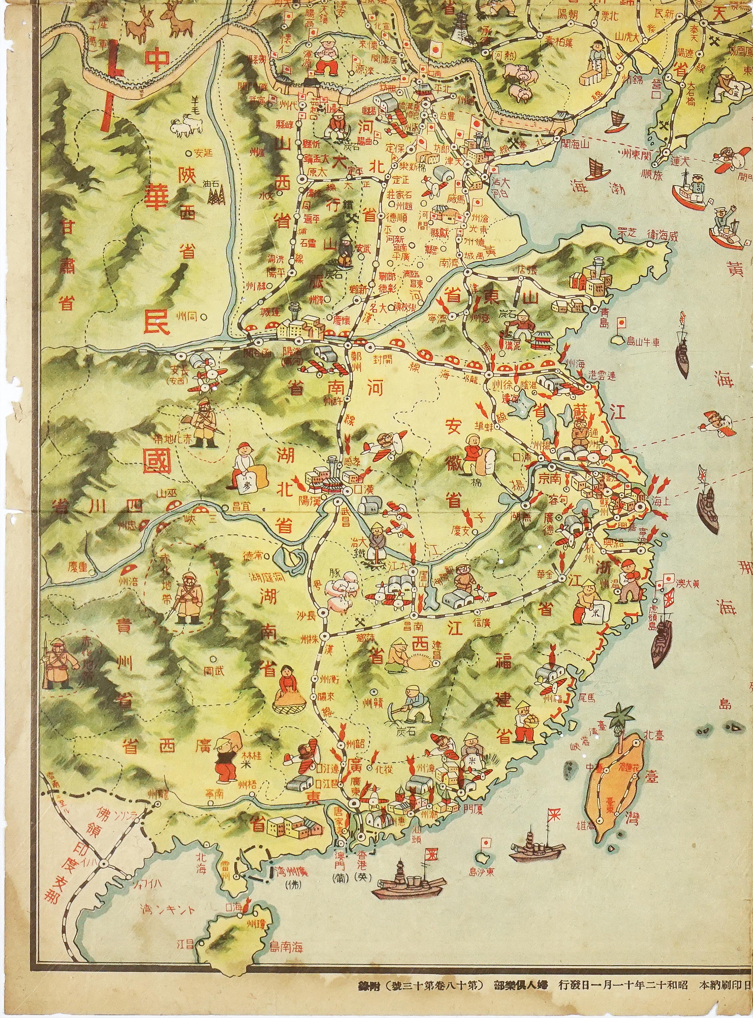
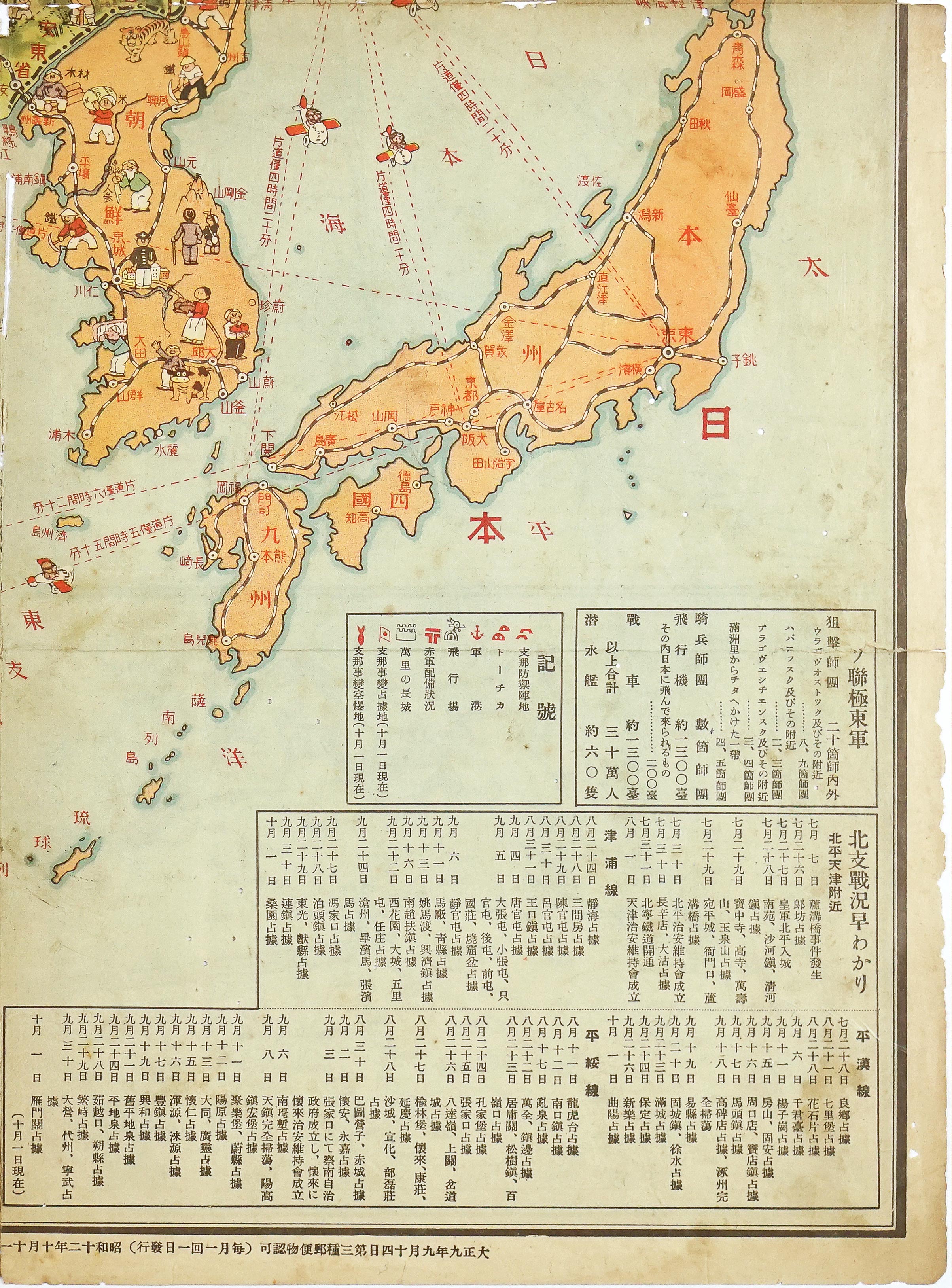


Published on November 1, 1937, as a fold-out supplement (furoku) in the popular women’s magazine Fujin Kurabu (Women’s Club), the Illustrated Map of the China Incident and Japan-Soviet Relations offered Japanese citizens a detailed visual account of a rapidly expanding war. Created by artist Kisoji Ishikawa, the map arrived at a pivotal moment. Only a few months prior, in July 1937, the Marco Polo Bridge Incident had ignited full-scale hostilities between the Empire of Japan and the Republic of China. Framed officially by Tokyo as the "China Incident" to avoid international legal constraints, the conflict required rapid public mobilization, and mass media played a central role in shaping home-front perceptions.
The primary goal of the map was to build domestic support and justify imperial expansion through an engaging, accessible medium. It achieves this by balancing serious military propaganda with a lighthearted, almost whimsical artistic style. Sprinkled alongside tactical markers are playful illustrations, such as smiling cartoon polar bears in the subarctic north near the Sea of Okhotsk, stylized agricultural animals, and local cultural vignettes. This disarming aesthetic softened the grim realities of total war, making complex geopolitical conflict easy to digest for everyday household readers while instilling a sense of confidence and order.
Central to the map’s narrative is a clear system of cartographic symbols designed to track the war's progress. Small Japanese flags mark major cities and strategic territories captured during the offensive up to October 1, 1937. These flags cluster tightly along critical railway corridors and key mountain passes along the Great Wall, such as Nankou and Juyongguan. Red bomb icons mark sites of Japanese air bombardments across northern China, showcasing the reach of imperial air power. Chinese defensive positions appear as red roof-like structures, while concrete pillboxes (tochka) are rendered as small red domes. To project stability within Japan's sphere of control, a local figure is depicted holding the flag of Manchukuo around its capital, Changchun (Čchang-čchun).
Despite the ongoing fighting in China, the map clearly frames the Soviet Union as Japan's ultimate strategic threat. A heavy double red line paired with red hammer-and-sickle symbols traces the northern borders of Manchuria and Mongolia, highlighting a dense concentration of Red Army troops. By depicting Soviet forces lurking directly along the frontier, the map subtly reassured the public that imperial forces were maintaining a vigilant forward defense against communism while simultaneously carrying out operations in China.
Reinforcing this message are detailed informational charts located in the map's bottom-right corner. This section features a comprehensive military intelligence chart outlining estimated Soviet strength in the Far East, listing roughly 300,000 troops, 1,200 aircraft, 1,300 tanks, and 60 submarines. Alongside these figures sits a detailed day-by-day chronological log titled "Understanding the Battle Situation in North China." Tracking Japanese victories from the initial outbreak on July 7 through October 1 across major railway fronts, these charts provided readers with concrete data, presenting the military campaign as an organized, victorious, and necessary endeavor.
Eisuke Ishida (石田英助) was a prominent Japanese illustrator and graphic artist active during the Showa era, known for creating colorful pictorial maps, game boards (sugoroku), and commercial illustrations for major publications like Fujin Kurabu.
Printed on thin paper, moderate to heavy signs of age and wear, minor holes along center fold.
Interested in buying this map?
We can ship worldwide! Ask for a shipping quote or let us know if you are considering buying this map.
Interested in the price of this map?
Ask us in the form below. We can ship worldwide!
Want to be notified when it becomes available again?Leave us your e-mail below and we will let you know.