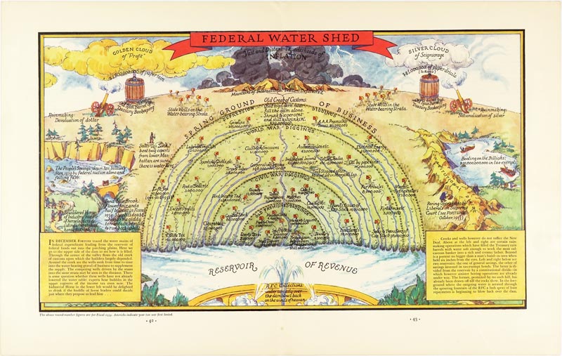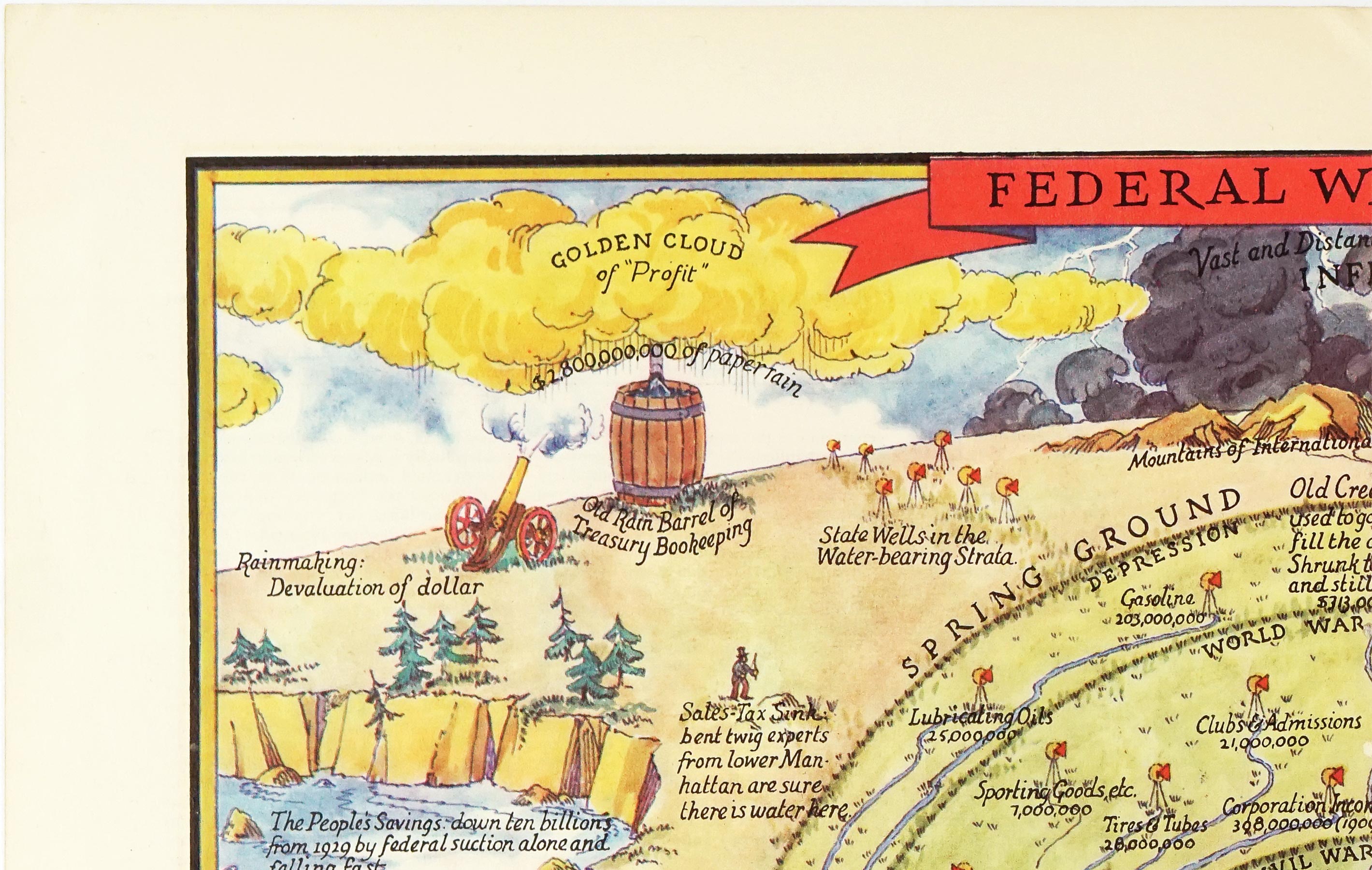
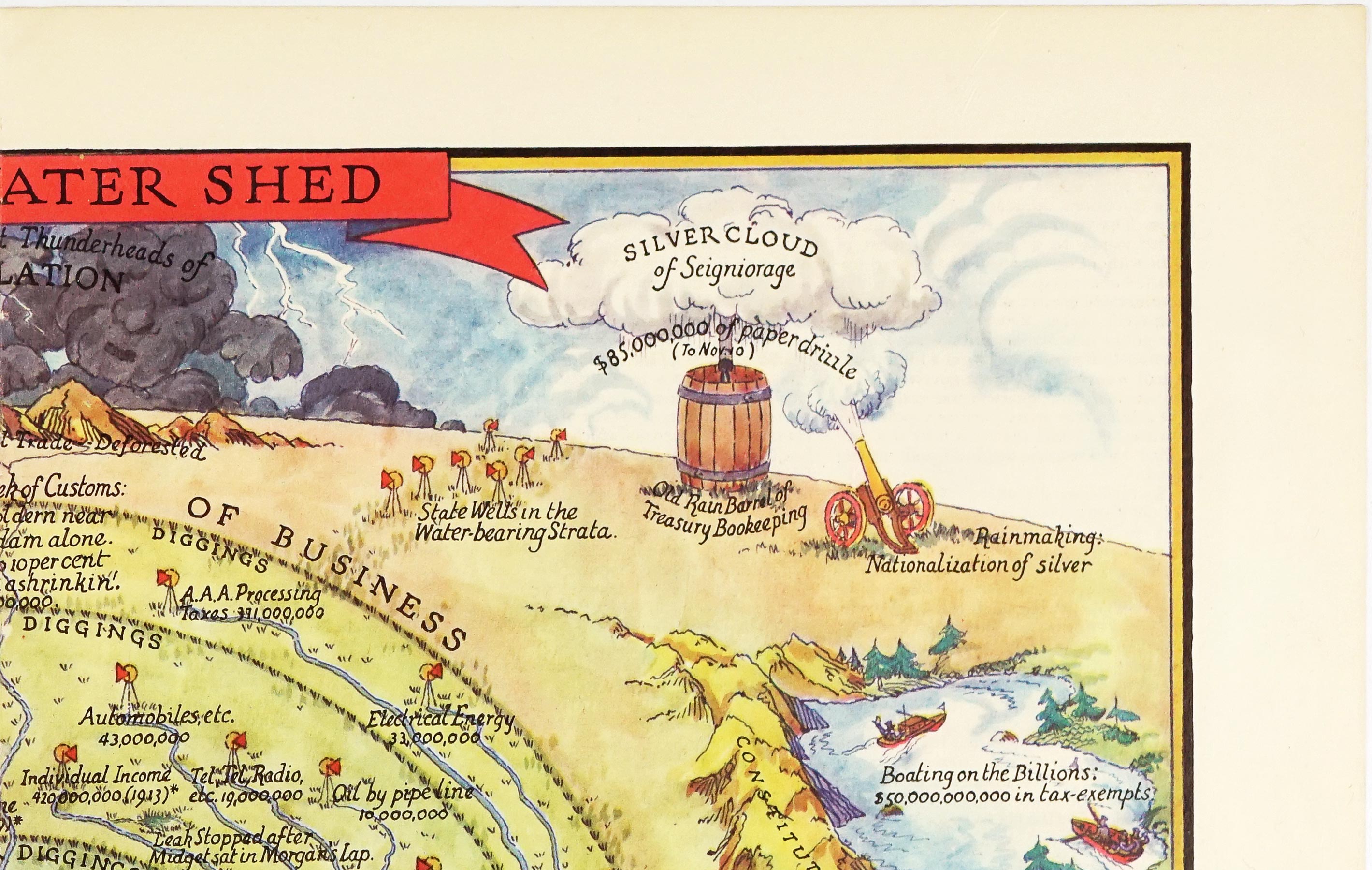
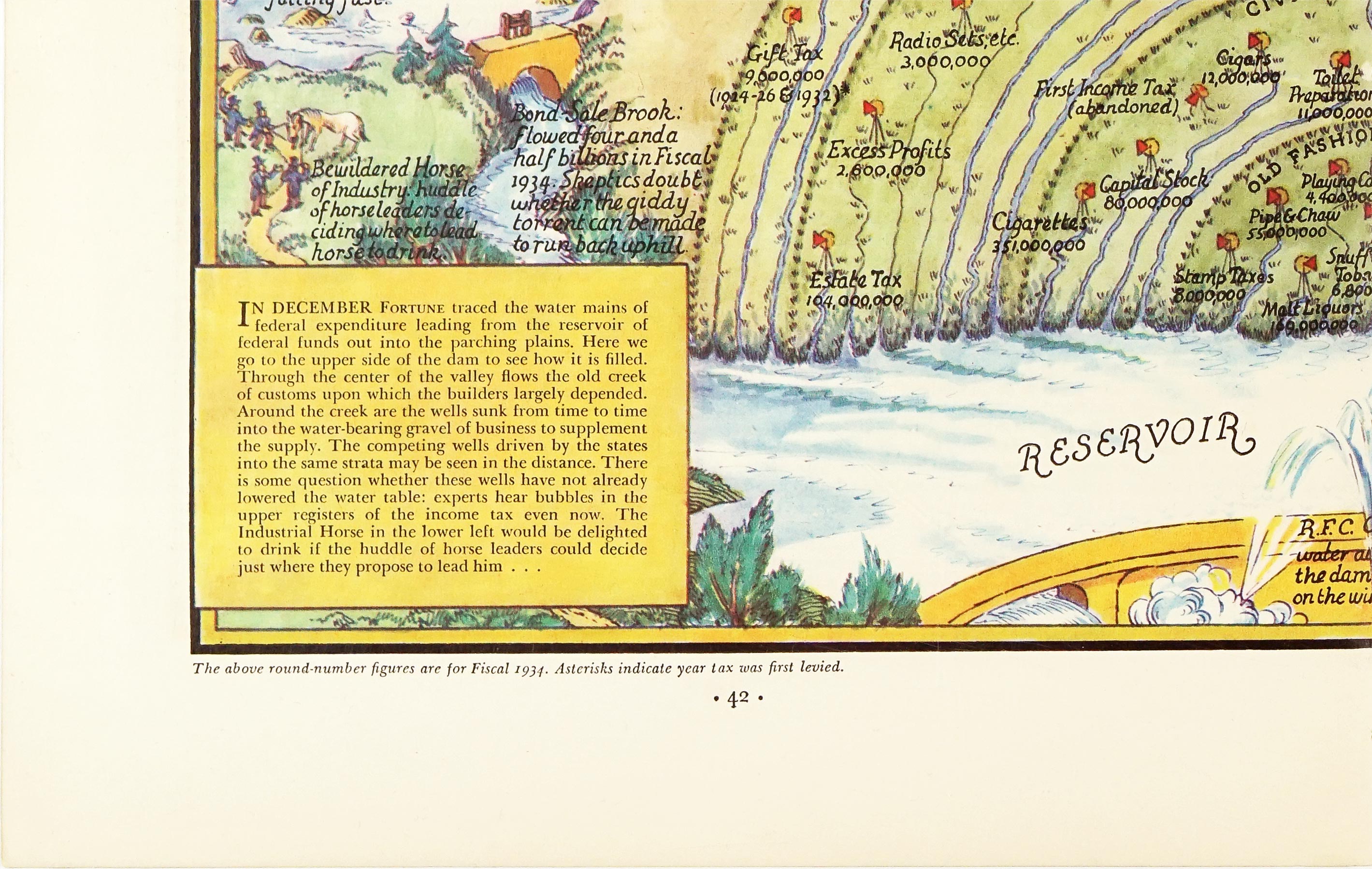

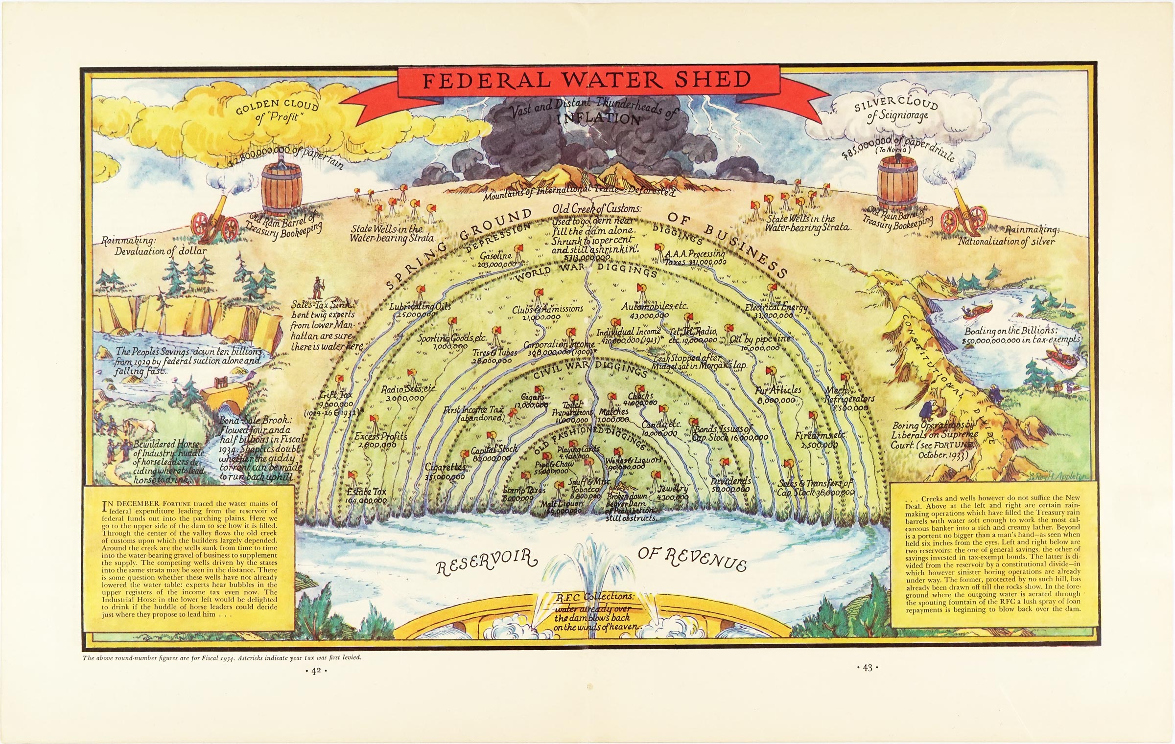


Published in 1935 in Fortune magazine, Federal Water Shed is an elaborate example of American allegorical and persuasive cartography by LeRoy H. Appleton. It followed Appleton's 1934 map Financial Irrigation of the United States, developing the earlier water-and-finance metaphor into an even more elaborate landscape.
The map transforms the American federal financial system into a vast watershed. At the bottom lies the “Reservoir of Revenue,” representing the federal Treasury, while streams, creeks and wells show the various sources feeding it. The “old creek of customs”, now shrunk to 10 % of the value before the great depression struck, represents customs duties, while numerous wells sunk into the “water-bearing strata” of business represent additional taxes and sources of federal revenue. The landscape is dominated by the “Ground of Business Depression” and the “Mountains of International Trade.”
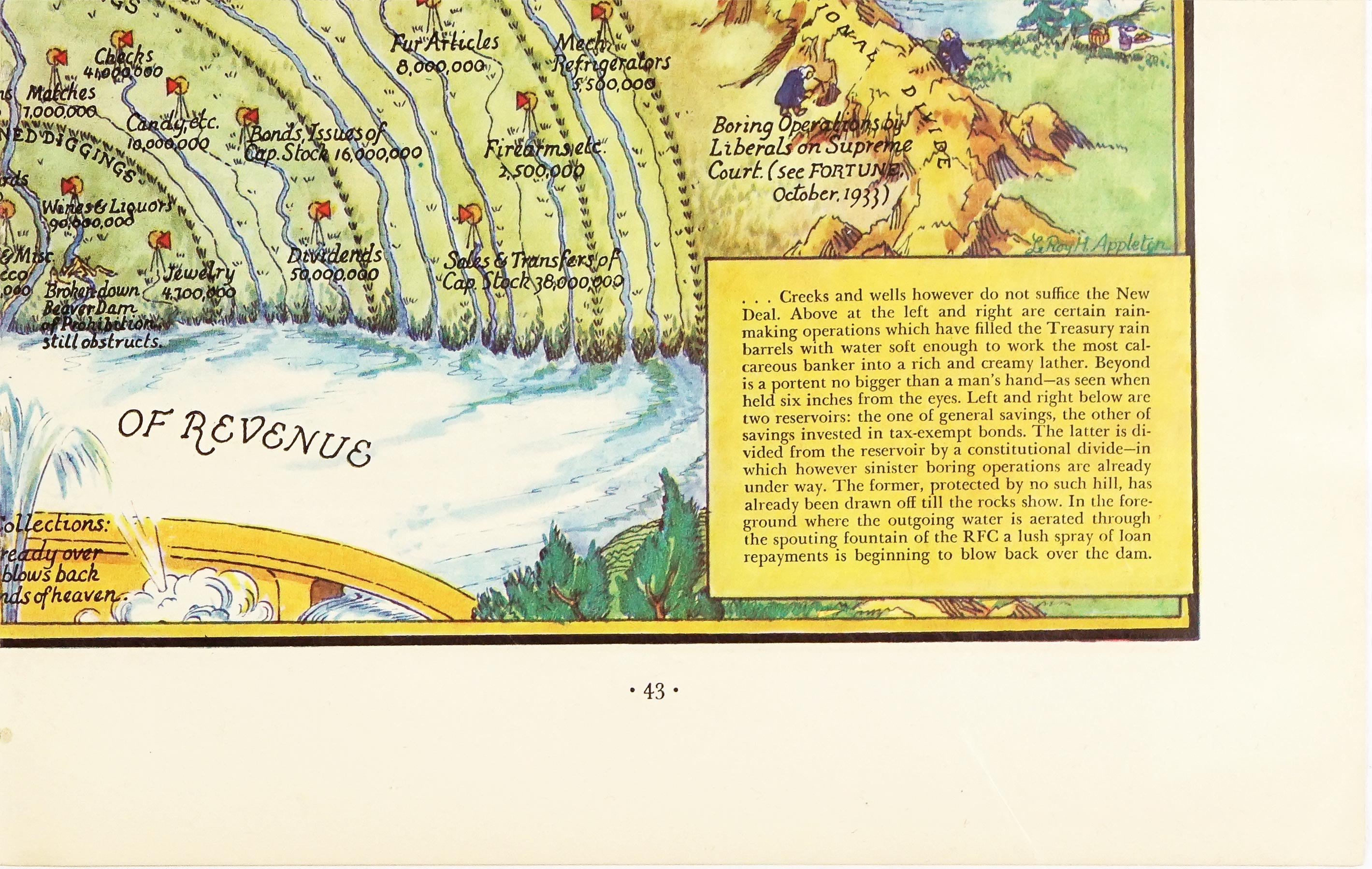
But the Treasury's water does not come from taxes alone. Above the landscape, Appleton depicts elaborate “rain-making” operations, representing extraordinary financial measures that help fill the Treasury's rain barrels. The accompanying text describes these measures with characteristic sarcasm, suggesting that the New Deal has developed increasingly elaborate ways of making money flow into the federal coffers.
Appleton also turns private wealth into part of the landscape. Two reservoirs represent general savings and savings invested in tax-exempt bonds. The former is shown as already having been largely drained, while the latter is separated from the federal system by a “Constitutional Divide.” The accompanying text warns that even this barrier is being subjected to “boring operations,” suggesting attempts to reach otherwise protected sources of wealth.
The map was created during the Great Depression, when Franklin D. Roosevelt's New Deal had dramatically expanded the federal government's role in economic relief and recovery. Federal spending and lending increased substantially, while programs such as the PWA, FERA, WPA and the Reconstruction Finance Corporation put Washington at the center of economic activity. The expansion provoked intense contemporary debate over taxation, government spending, private enterprise and the constitutional limits of federal power.
Appleton's map reflects the critical side of that debate. Its central question is essentially how far the financial “wells” of the American economy can be sunk before the water table falls. In the foreground, the Reconstruction Finance Corporation is represented as a fountain whose spray of loan repayments flows back toward the federal reservoir, incorporating federal lending into the same elaborate financial cycle.
Very good condition overall with very little signs of age. Folded in half.
Interested in buying this map?
We can ship worldwide! Ask for a shipping quote or let us know if you are considering buying this map.
Interested in the price of this map?
Ask us in the form below. We can ship worldwide!
Want to be notified when it becomes available again?Leave us your e-mail below and we will let you know.