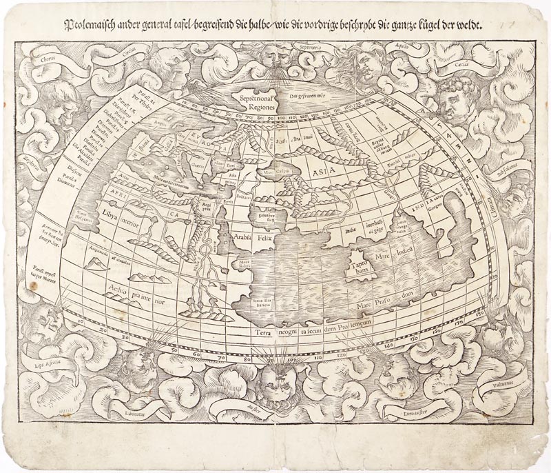
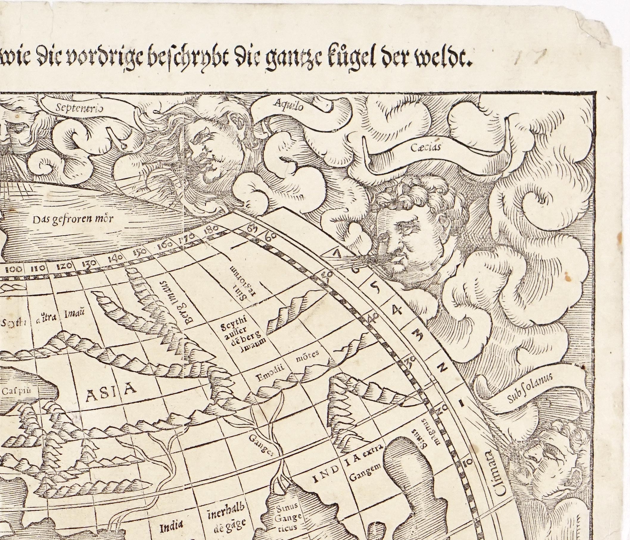

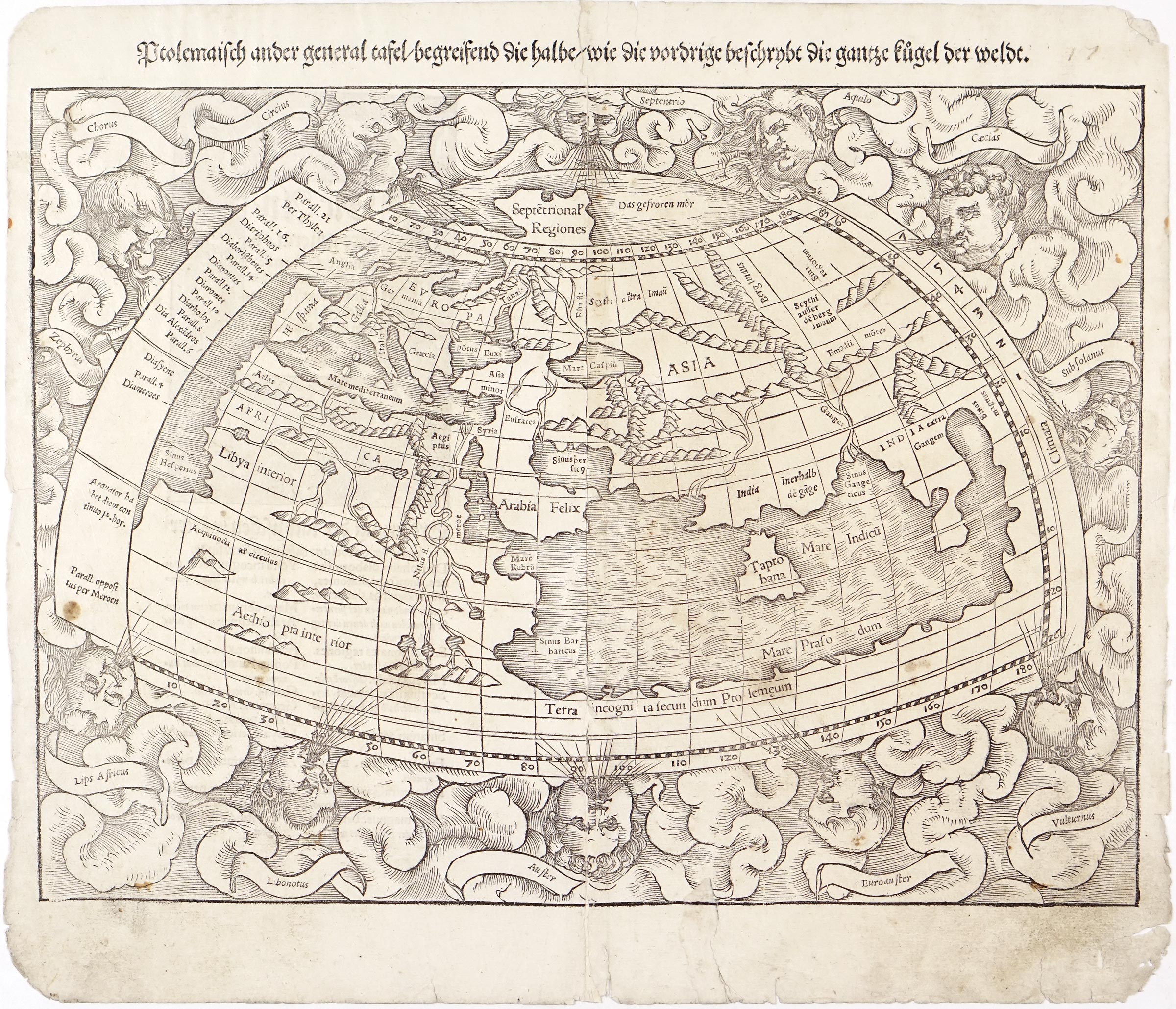


This original antique Ptolemaic map of the world comes from the first German-language edition of Sebastian Münster's Cosmographia, published in Basel in 1544. The woodcut print presents a faithful reconstruction of the known world according to the 2nd-century principles of Claudius Ptolemy. Münster deliberately included this classical depiction alongside modern maps to illustrate the dramatic expansion of geographical knowledge during the Renaissance.
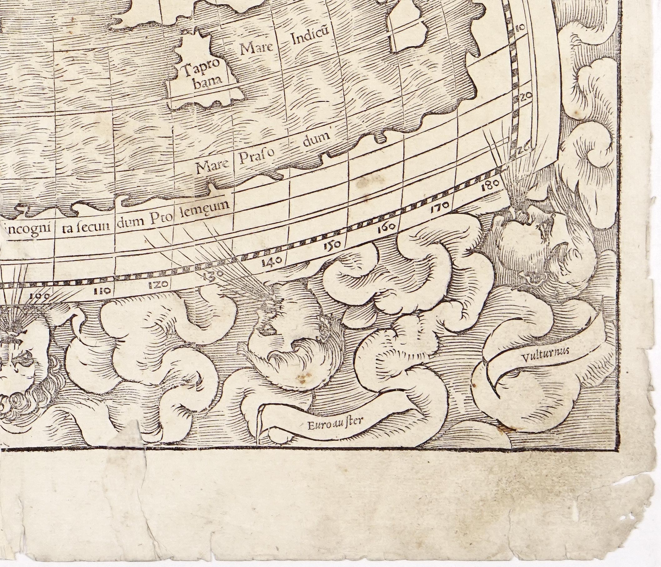
Cartographically, the map utilizes Ptolemy's modified conic projection, featuring curved parallels and converging meridians to depict the Old World—Europe, North Africa, and Asia. Notable classical features include a landlocked Indian Ocean (Mare Indicum) enclosed by an imaginary southern continent (Terra incognita), and an exaggeratedly large island of Taprobana (Sri Lanka) south of India. Because it strictly reflects classical antiquity, the Americas and the Pacific Ocean are entirely absent.
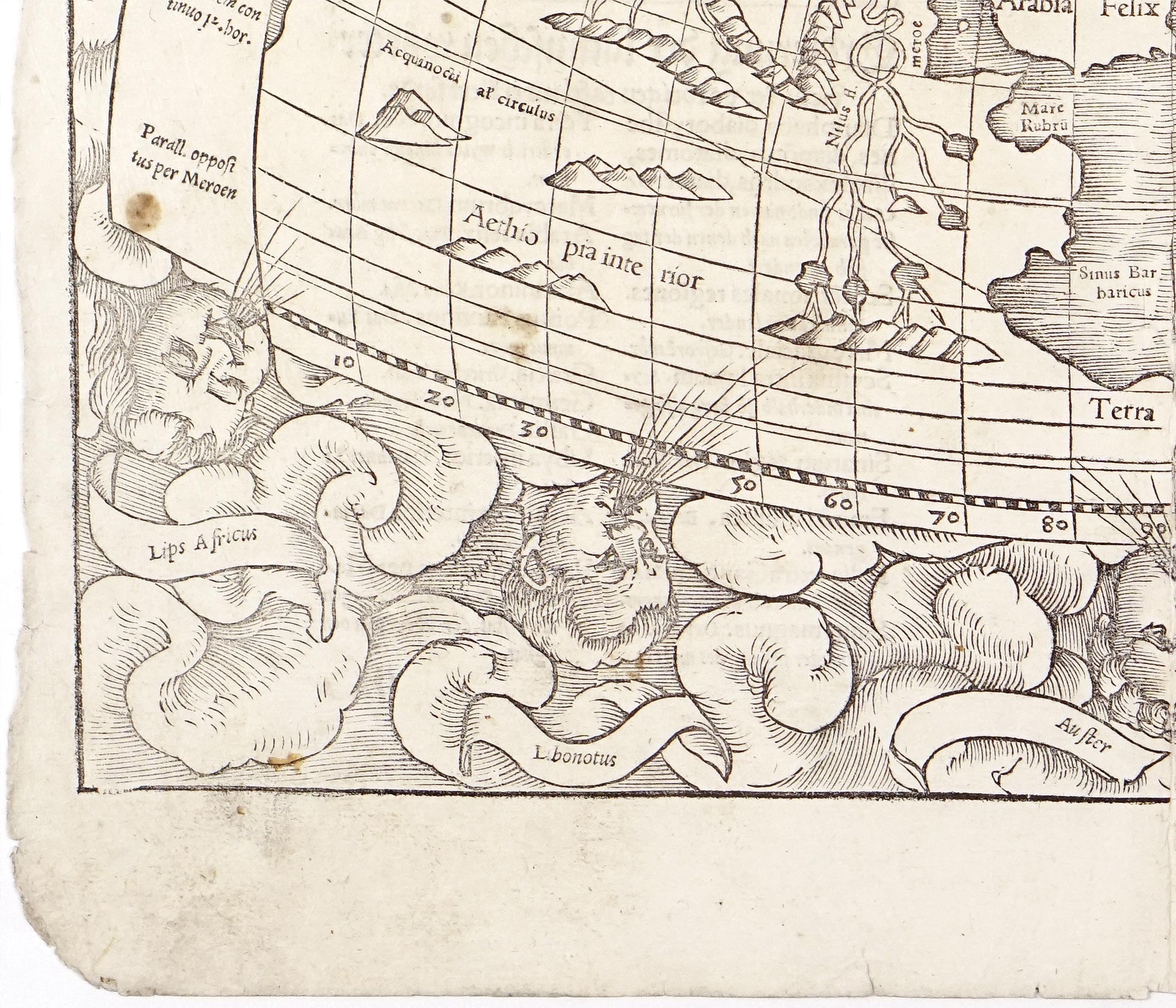
Further examining the original woodcut print we find several other prominent geographical features, landmark labels, and structural details across the Ptolemaic world:
In North Africa, the Nile River (Nilus) is depicted according to Ptolemaic belief, originating far to the south from two distinct inland lakes fed by the "Mountains of the Moon". Nearby, the Red Sea (Mare Rubrum) forms a narrow gulf separating Africa from the Arabian Peninsula (Arabia Felix). Further north and east, the map outlines major mountain chains that defined ancient Asian geography. In addition to the Emodii motes along the eastern reaches, the vast Imaus Mons (Berg Imaus) range stretches across central Asia, functioning in classical cartography as the primary divide separating Scythia intra Imaum (Scythia inside the mountains) from Scythia extra Imaum (Scythia beyond the mountains). Near the Caspian Sea (Mare Caspiu), which Ptolemy famously rendered as an inland sea, the Caucasus range (Caucasus Mons) stands between Europe and Asia.
Across the Asian subcontinent, two great river systems dictate the topography: the Indus River in the west and the Ganges River in the east, which divides the region into India inerhalb de gáge (India within the Ganges) and India extra Gangem (India beyond the Ganges). To the south lies the enclosed Indian Ocean (Mare Indicum), bounded by a vast southern landmass labeled Terra incognita secundum Ptolemeum (Unknown land according to Ptolemy), which seals off the ocean from the rest of the globe.
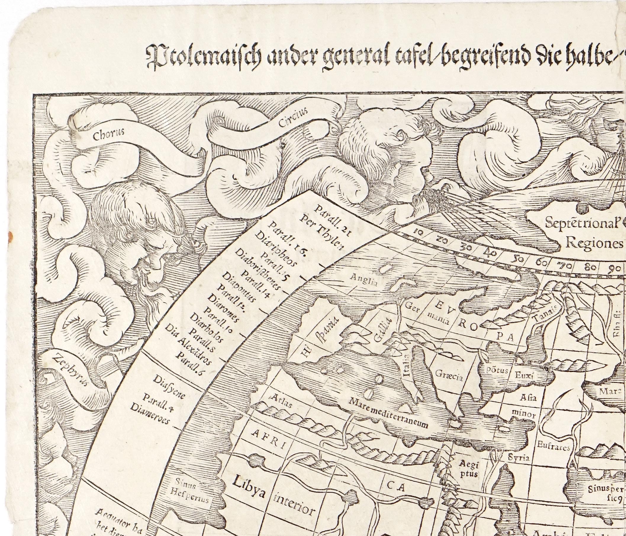
Along the left margin, a detailed vertical grid lists the classical climata (climatic zones) and parallels (Paralleli), extending from south of the Equator (Aequinoctialis) northwards past Britain (Anglia) to Far North. Surrounding the entire hemisphere, the twelve named wind heads (Venti) puff stylized clouds and air streams into the map, anchoring the classical grid within a traditional Renaissance woodcut border.
Good condition overall, strong impression. Some deterioration of the paper along the edges.
Interested in buying this map?
We can ship worldwide! Ask for a shipping quote or let us know if you are considering buying this map.
Interested in the price of this map?
Ask us in the form below. We can ship worldwide!
Want to be notified when it becomes available again?Leave us your e-mail below and we will let you know.